SPECIFICATIONS
| BRAND | Garmin Navionics+ |
|---|---|
| PRODUCT | Navionics+ charts and maps |
| PART NUMBER | 010-C1351-40 |
| REGION | Mediterranean & Black Seas |
| MAP TYPE | Coastal and inland marine cartography |
| COMPATIBILITY | Wide range of compatible chartplotter brands |
| SUBSCRIPTION INCLUDED | 1-year subscription |
| DAILY CHART UPDATES | Via Navionics chart installer software |
| DOCK-TO-DOCK ROUTE GUIDANCE | Advanced route guidance technology uses boat settings, chart data and frequently traveled routes to calculate a suggested path from dock to dock |
| CONTOURS | Up to 1′ contours |
| ADVANCED MAP OPTIONS | Highlight shallow areas, adjust contour density or select a fishing range |
| COMMUNITY EDITS | Download useful local knowledge added by users of the Navionics Boating app and view it on a compatible chartplotter |
| PLOTTER SYNC | Transfer routes and markers, update charts and more between plotter card and mobile app wirelessly; activate or renew cartography subscription and upload sonar logs |
| SONARCHART LIVE MAPPING | Create maps on the fly and watch new 1′ HD bathymetry maps develop in real time as the boat moves through the water |
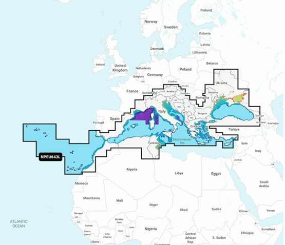
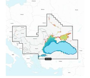
COVERAGE
Detailed coverage of the Mediterranean and Black Seas. Coverage includes islands, straits, rivers, lakes and key ports across Southern Europe, North Africa and the Black Sea region.
| SEAS | Mediterranean Sea, Black Sea, Sea of Azov |
|---|---|
| ISLANDS AND REGIONS | Azores, Madeira, Canary Islands, Gibraltar, Balearic Islands, Corsica, Sardinia, Sicily, Malta, Crete, Cyprus |
| STRAITS | Dardanelles, Bosporos |
| RIVERS | Dneiper River to the Kyivs’ke Reservoir, Danube River to Passau, Germany |
| LAKES | Lake Balaton, Lake Garda, Lake Como, Lake Maggiore |
| PORTS | Cadiz and Barcelona, Spain; Monaco; Marseille and Toulon, France; Genoa, Naples, Taranto and Venice, Italy; Istanbul, Türkiye; Odessa, Ukraine; Tunis, Tunisia and Algiers, Algeria |
Reviews
There are no reviews yet.